
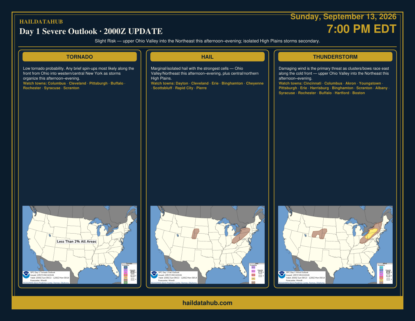
Day 1 Outlook UPDATE — Sunday, September 13, 2026 · 2000Z · Slight Risk Northeast (SITE-X landscape). SPC 20Z update: minor changes; prior reasoning still valid. Damaging wind remains the primary threat as clusters/bows race east along a cold front this afternoon through evening across the upper Ohio Valley into central New York / the Northeast. Marginal/isolated hail with the strongest cells. Isolated High Plains storms are secondary.
Corridor / towns: Cincinnati · Columbus · Akron · Youngstown · Pittsburgh · Erie · Harrisburg · Binghamton · Scranton · Albany · Syracuse · Rochester · Buffalo · Hartford · Boston — plus High Plains watch towns Cheyenne · Scottsbluff · Rapid City · Pierre.
Watching (not ALERT): No Day 4–8 severe areas drawn. Soft signal only — Wednesday focus OH into the lower Missouri Valley.
Archive graphic for the HailDataHub phone scroller. Same-day refreshes post as separate cards so the year-scale timeline stays readable (morning + 1630 cards unchanged).
Download SITE-X PDF · Terms · haildatahub.com · Opening more spots soon
Soft unlock: Full SITE-X card above — create a free account anytime for more HailDataHub tools. Not a government product; summary of public NOAA SPC outlooks.