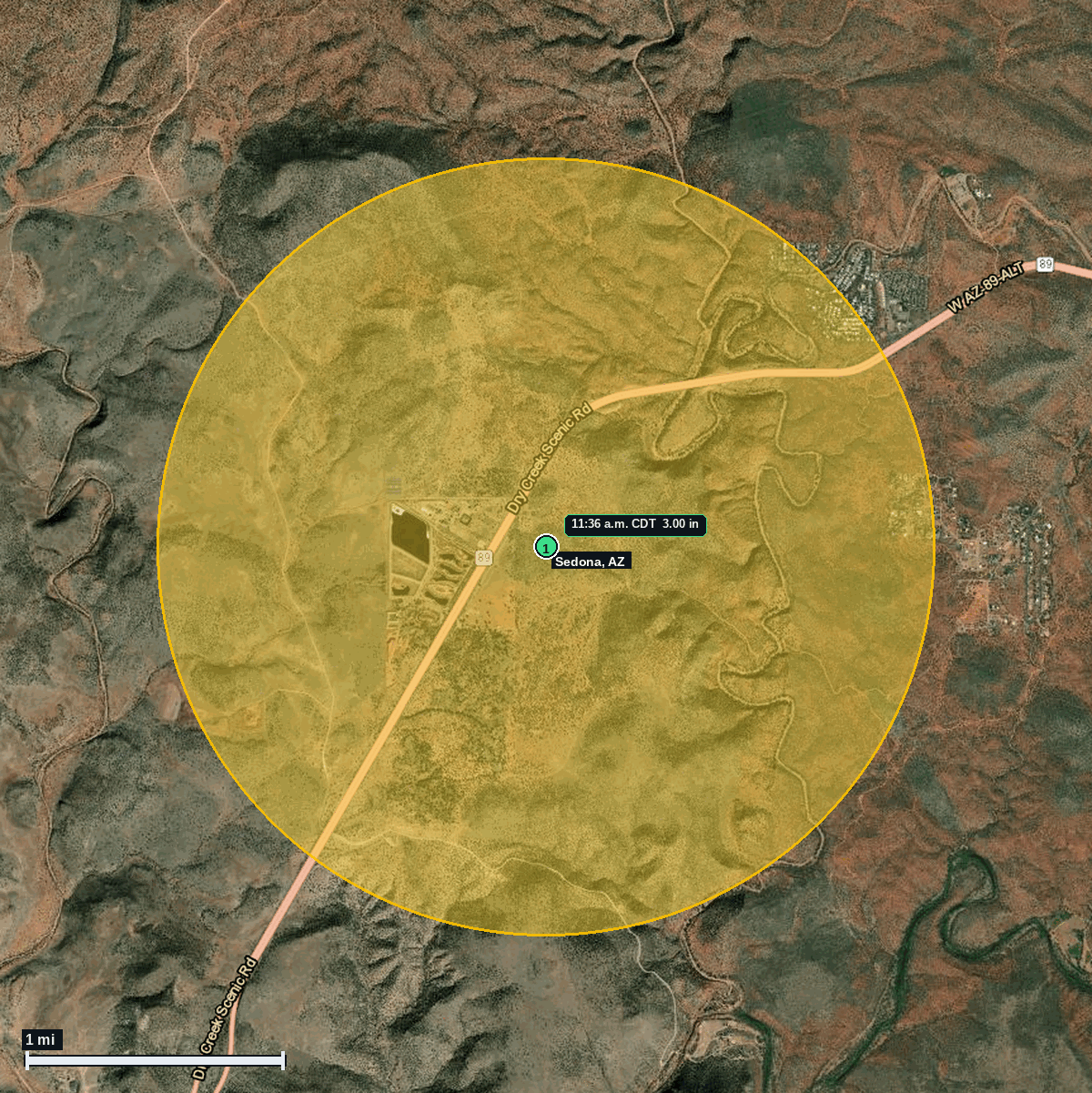
Near Sedona, AZ: 3.00 in Hail (Yavapai County), Oct 22, 11:36 AM CDT
Report # HDH-AZ-261022-02 · 11:36 a.m. CDT
Live report · October 22, 2026 storm (9:36 AM MST Arizona local). All times Central (CDT).
Population: Sedona city, AZ, population 9,777 (ACS 2024 5-year, place FIPS 0465350); Cornville CDP, AZ, population 3,618 (ACS 2024 5-year, place FIPS 0415920)
Thursday, October 22, 2026 · 1 hail report · max 3.00 in (size comparison: about tea cup) near 5 N Page Springs
Yavapai County, AZ · NWS Flagstaff (WFO FGZ) · 11:36 a.m. CDT
- 3.00 in (5 N Page Springs) · 11:36 a.m. CDT · 34.83, -111.89 · Live report: 3.00 in (tea cup size), public report via the NWS Flagstaff X page.
Source: NWS Flagstaff Local Storm Report (IEM LSR archive).
The report fell inside NWS Flagstaff Tornado Warning 12 (issued 11:30 AM CDT for radar indicated rotation, max hail tag 1.00 in; IEM lists it ending 11:42 AM CDT). At issuance NWS placed the storm near Village of Oak Creek, about 6 miles south of Sedona, moving north at 55 mph.
One report of 1.25 in or larger to NWS Flagstaff: 3.00 in (tea cup size) at 5 N Page Springs, a public report from the NWS Flagstaff X page. Arizona local time was 9:36 AM MST on Oct 22. NWS Flagstaff also logged a funnel cloud west of Sedona at the same time and place.
The report point is in the Verde Valley about 5.8 mi west-southwest of Sedona and 6.3 mi north of Cornville (Census place centers), about 19 mi north-northwest of Camp Verde.
Town map