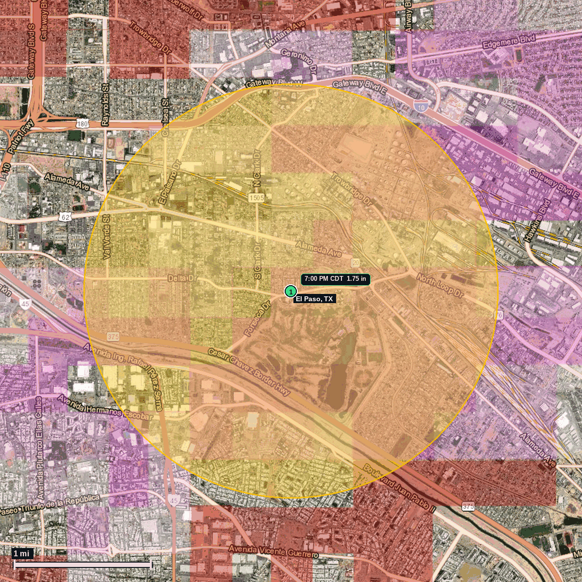
El Paso, TX: 1.75 in Hail (El Paso County), Oct 23, 7:00 PM CDT
Report # HDH-TX-261023-01 · 7:00 PM CDT
Delayed report · October 23, 2026 storm (6:00 PM MDT Texas local). All times Central (CDT).
Population: El Paso city, TX, population 680,130 (ACS 2024 5-year, place FIPS 4824000)
Friday, October 23, 2026 · 4 hail reports · max 1.75 in (size comparison: about golf ball) near 4 S Fort Bliss
El Paso County, TX · NWS El Paso/Santa Teresa (WFO EPZ) · 7:00 PM CDT
- 1.75 in (4 S Fort Bliss) · 7:00 PM CDT · 31.76, -106.41 · Delayed report: 1.75 in (golf ball), public report to NWS El Paso: golf course greens damaged with thousands of large divots.
- 1.00 in (Near University of Texas at El Paso) · 6:55 PM CDT · 31.77, -106.51 · Live report: 1.00 in (quarter), public report.
- 1.00 in (2 S Fort Bliss (Costco, I-10 at Towbridge Dr)) · 7:00 PM CDT · 31.78, -106.41 · Live report: 1.00 in (quarter), public report: hail covering the ground in a Costco parking lot.
- 1.00 in (3 S Fort Bliss) · 7:00 PM CDT · 31.76, -106.43 · Live report: 1.00 in (quarter), trained spotter; also 1.5 in of rain and gusts of 45 to 50 mph.
Source: NWS El Paso/Santa Teresa Local Storm Reports (IEM LSR archive).
NWS El Paso Severe Thunderstorm Warning 192 (6:34 to 7:15 PM CDT, hail tag 1.25 in at issue, wind 60 mph) was in effect at the 7:00 PM CDT report.
NWS El Paso logged golf ball size hail (1.75 in) 4 mi south of Fort Bliss at 7:00 PM CDT Oct 23 (6:00 PM MDT local), from a public report: golf ball hail damaged the greens on a golf course with thousands of large divots in the turf.
This report was added late: NWS El Paso issued it at 4:17 PM CDT Oct 24 (3:17 PM MDT), about 21 hours after the storm. Earlier same-storm reports were 1.00 in (quarter size).
The report point is inside the El Paso city limits, about 6 mi south of the El Paso city center point (Census place center).
Town map