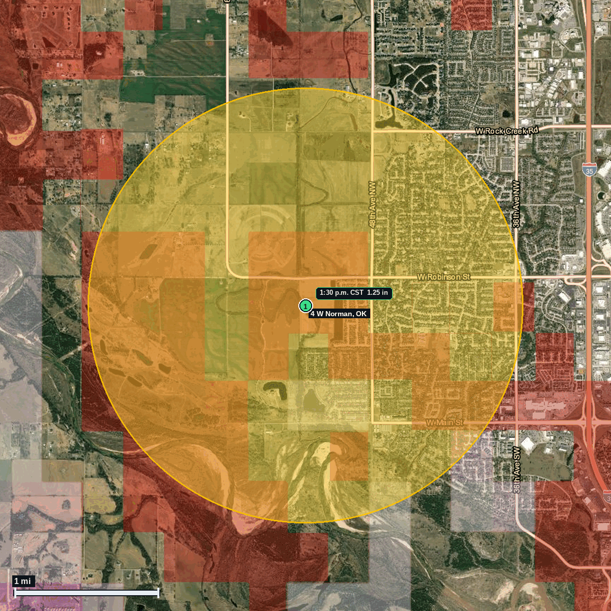
4 W Norman, OK: Estimated 1.25 in Hail (Cleveland County), Nov 2, 1:30 PM CST
Report # HDH-OK-261102-01 · 1:30 p.m. CST
Live report · November 2, 2026 storm (1:30 PM CST, 12:30 PM MST). All times Central (CST), MST shown where noted.
Population: Norman city, OK, population 129,672 (ACS 2024 5-year, place FIPS 4052500)
Monday, November 2, 2026 · 4 hail reports · max 1.25 in (size comparison: about half dollar) near 4 W Norman
Cleveland County, OK · NWS Norman (WFO OUN) · 1:30 p.m. CST
- 1.25 in (4 W Norman) · 1:30 p.m. CST · 35.23, -97.52 · Live report: estimated 1.25 in (public mPING report, radar-adjusted time), about half dollar size.
- 1.00 in (4 W Norman) · 1:32 p.m. CST · 35.24, -97.51 · Live report: 1.00 in (quarter size), public mPING report. Context only.
- 1.00 in (5 NW Moore (Cleveland Co.)) · 1:11 p.m. CST · 35.37, -97.58 · Live report: 1.00 in (quarter size), public report. Context only.
- 1.00 in (4 W Valley Brook (Oklahoma Co.)) · 1:13 p.m. CST · 35.40, -97.56 · Live report: 1.00 in (quarter size), public report, Oklahoma County (not Cleveland). Context only.
Source: NWS Norman Local Storm Report, estimated 1.25 in (public mPING report, radar-adjusted time), and SPC Storm Reports (IEM LSR archive).
The 1.25 in report fell inside NWS Norman Severe Thunderstorm Warning 981 (1929-2015Z, 1:29 to 2:15 PM CST, which is 12:29 to 1:15 PM MST). SPC Tornado Watch 701 was in effect (issued 1927Z, 1:27 PM CST).
Largest hail: estimated 1.25 in (public mPING report, radar-adjusted time), about half dollar size, at 4 W Norman, Cleveland County, at 1:30 PM CST (1930Z, 12:30 PM MST), listed in NWS Norman Local Storm Report 202611021948-KOUN and on SPC and IEM storm reports.
Context only (1.00 in, quarter size, public reports): 5 NW Moore, Cleveland County, at 1:11 PM CST (1911Z); 4 W Valley Brook, Oklahoma County, at 1:13 PM CST (1913Z); and 4 W Norman, Cleveland County, at 1:32 PM CST (1932Z, mPING report). These are not part of the yellow swath.
Town map