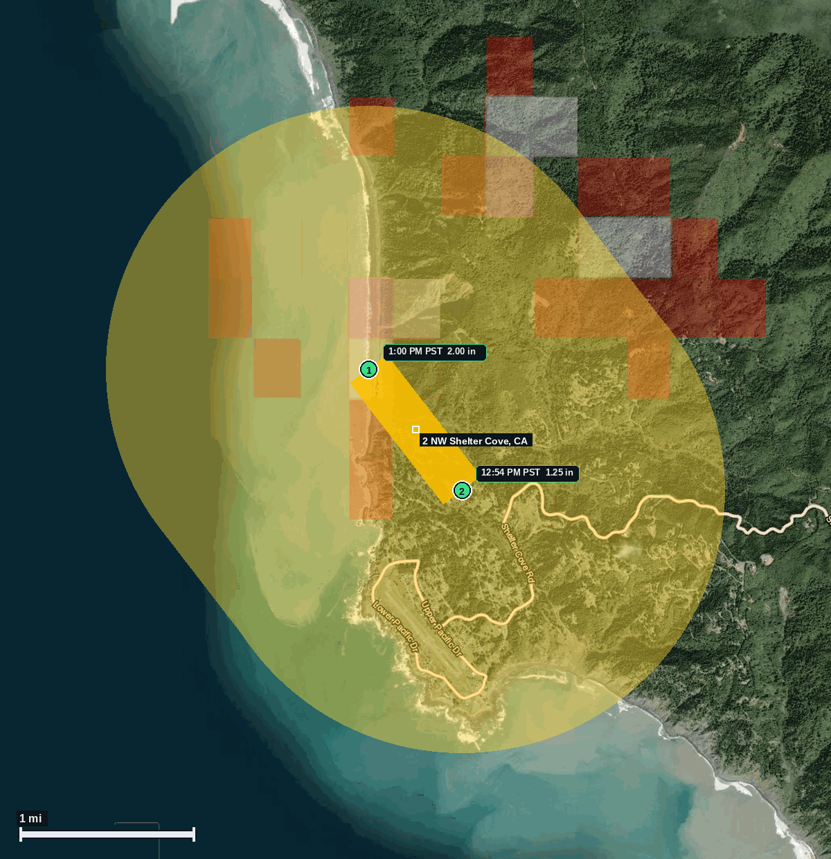
2 NW Shelter Cove, CA: 2.00 in Hail (Humboldt County), Nov 13, 1:00 PM PST
Report # HDH-CA-261113-01 · 1:00 PM PST
Live report · November 13, 2026 storm (largest 1:00 PM PST, 2:00 PM MST; 1 NW Shelter Cove 12:54 PM PST, 1:54 PM MST; time and location of the 1.25 in report estimated by radar). All times Pacific (PST), MST shown where noted.
Population: Shelter Cove CDP, CA, 543 (ACS 2024 5-year). The impact ESTIMATE is the yellow swath, not the full-town count.
Friday, November 13, 2026 · 2 hail reports · max 2.00 in (size comparison: about hen egg) near 2 NW Shelter Cove
Humboldt County, CA · NWS Eureka · 1:00 PM PST
- 2.00 in (2 NW Shelter Cove) · 1:00 PM PST · 40.05, -124.08 · Live report: 2.00 in (public), about hen egg size, near Black Sands Beach. Preliminary NWS Eureka Local Storm Report.
- 1.25 in (1 NW Shelter Cove) · 12:54 PM PST · 40.04, -124.07 · Live report: estimated 1.25 in (public), about half dollar size. Time and location estimated by radar.
Source: NWS Eureka Preliminary Local Storm Reports, 2.00 in at 2 NW Shelter Cove near Black Sands Beach (public) and estimated 1.25 in at 1 NW Shelter Cove (public; time and location estimated by radar), and SPC Storm Reports (IEM LSR archive).
Largest hail: 2.00 in (public), about hen egg size, at 2 NW Shelter Cove near Black Sands Beach, Humboldt County, at 1:00 PM PST (2100Z, 2:00 PM MST), listed in the NWS Eureka Preliminary Local Storm Report issued at 3:20 PM PST and on SPC and IEM storm reports. A second official report of estimated 1.25 in (public), about half dollar size, was listed 1 NW Shelter Cove at 12:54 PM PST (2054Z, 1:54 PM MST), time and location estimated by radar, in the NWS Eureka Preliminary Local Storm Report issued at 1:48 PM PST. Both 1.25 in or larger reports are in the yellow swath.
NWS Eureka listed both reports as preliminary. This card uses the official sizes as published and does not treat either figure as a later-reviewed Storm Data entry.
Town map